Introduction
- Depending on the subject, the purpose of the 3D modelling and the acquisition de
vice, mission planning will vary from one project to another. Each scenario has to be carefully considered before going to field and starting the acquisition - This guide provides some image capture techniques for achieving the best possible 3D reconstructions
Before you begin
- Before you capture any images, you need to know the level of detail required for your project. Calculate the ground sampling distance (GSD) you want to capture and plan your flights accordingly. This step is vital because the accuracy of a measurement is directly related to the ground sampling distance of the original images – so take the time to double-check it’s right
- Try to fly a constant height over terrain to achieve an even GSD
- Overlap is king. If you are not confident that you have sufficient image overlap, consider capturing more. Remember, you can remove extra information but cannot create something from nothing
- Ensure you capture images slightly beyond the extent of the area of interest. The reconstruction is created from overlapping images so it may be biased or inaccurate if a feature is only captured from one side
- When possible avoid bright sunny days to avoid reflections and differing lighting condition at various angles
- Precise ground control points (GCPs) are strongly recommended. GCPs not only improve a project’s absolute accuracy but also validate its relative accuracy as well
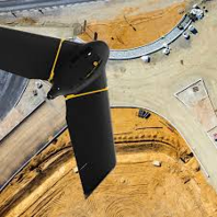
 Capture Technique - Nadir Images
- Nadir Images are helpful to tie all imagery together, and in many cases are all that are required for generating quality Ortho-photo and DSM productions
- Typical overlap 80 % forward 60% side overlap are required
 Capture Technique - Oblique Images
- Obliques flight lines inherently contain more information and allow for vertical structure detail. Essential for reconstructing building facades etc
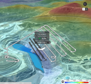
Capture Technique - Overlapping Circles
Adding overlapping circles can be used to:- Increase the robustness of the aero-triangulation
- Fly close to the structure to capture features in more detail
- Improve the rendering of complex structures with thin members
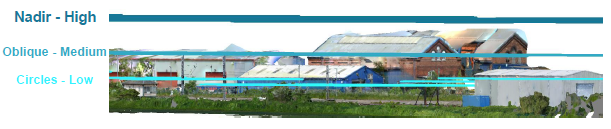
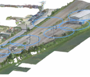
Capture Technique - Combining Nadirs, Obliques and Circles
For the different acquisition passes to merge correctly, the ground sampling distance and the viewing angle must not change too drastically from one vantage point to the other
- The flight height should not be increased more than twice between flights
- Avoid changing the camera orientation by more than 15 degrees at a time
- Maintain a 70% overlap between various heights (levels)
Capture Technique - the Final Word
To maximize the resolution and accuracy of the output model, consider combining the images captured by UAV with point clouds from terrestrial or mobile laser scanners for specific areas of interest