SmartFix - GPS/Glonass Fixed Cells - Waikato Region
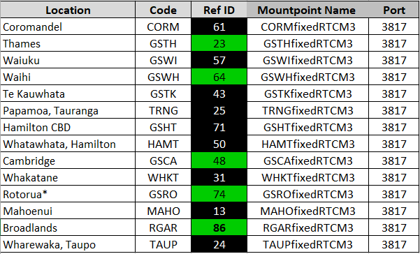
The Waikato fixed Network Solution comprises the following 14 sites.

Note: New sites get 12th order and get upgraded with time
The Master Site is selected from the Mountpoint list, this will usually be the closest, the best Auxiliary sites are automatically selected. The Master site will not switch, any problems and the user must selects an alternative Master.
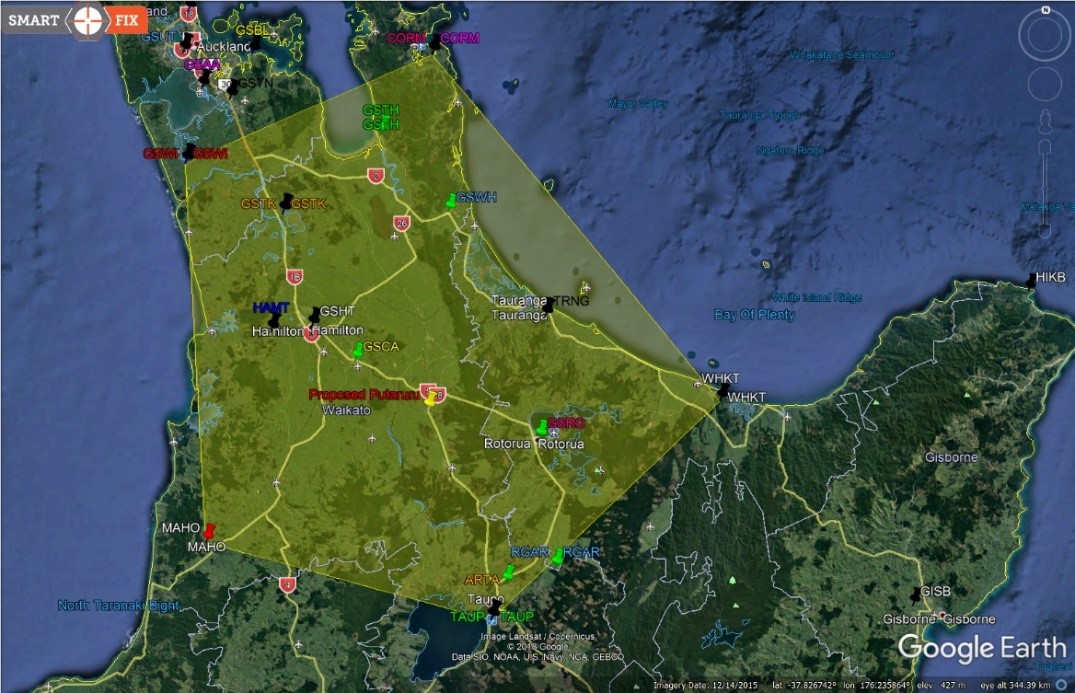
The coverage area is shown in Google earth below, if you initialise inside the area you can continue for 3 km outside the boundary. If outside the boundary you will only be able to work and initialise 1 km outside.
Black Icons and shading in Ref Id are Beidou sites the Green indicates GPS/Glonass sites. Light shading is the 3km outside coverage area.

![Hexagon GS Clearcut x400.png]](https://knowledgebase.globalsurvey.co.nz/hs-fs/hubfs/Hexagon%20GS%20Clearcut%20x400.png?width=80&height=72&name=Hexagon%20GS%20Clearcut%20x400.png)