SmartFix - Beidou Network - South Island Region
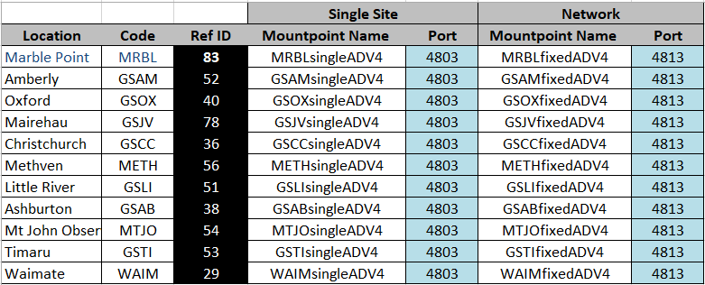
The following 11 sites in the South Island are used in a Beidou Network.

RTCM3 = RTCM V3.0 or V3.1
ADV4 = RTCM V3.2 message MSM4
ADV5 = RTCM V3.2 message MSM5
Recommended Type
Single Site = Nearest
Fixed Cell = i-Max
There are 11 sites in the Canterbury Area that meet the requirement to create a Beidou Network.
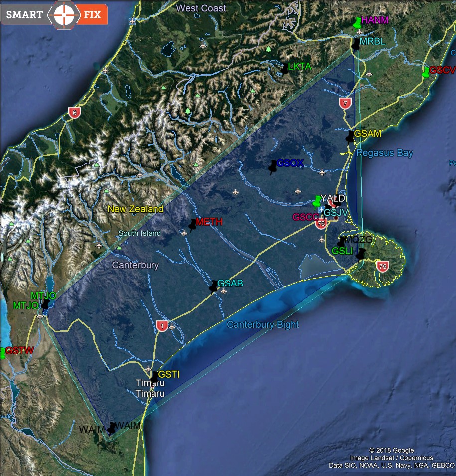
Note because not all Canterbury sites are Beidou capable the Network Coverage area is different to the GPS/Glonass coverage area. Also to reduce the data bandwidth with the extra satellites Beidou Network uses i-Max rather than the Max solution used by GPS/Glonass Network.
The Master Site is manually selected from the Mountpoint list, this will usually be the closest, the best Auxiliary sites are automatically selected. The Master site will not switch, if the Master goes down the user must select an alternative Master.
The coverage area is shown in Google earth below, if you initialise inside the area you can continue for 3 km outside the boundary. If outside the boundary you will only be able to work and initialise 1 km outside.
Black Icons and black Ref Id background are Beidou sites the Green indicate GPS/Glonass sites, light shading indicates 3km outside coverage area.

![Hexagon GS Clearcut x400.png]](https://knowledgebase.globalsurvey.co.nz/hs-fs/hubfs/Hexagon%20GS%20Clearcut%20x400.png?width=80&height=72&name=Hexagon%20GS%20Clearcut%20x400.png)