- Transfer your job (Measurements) from the LS15 digital level as an XML to a USB stick. This includes the position information as well as the levelling information that can be viewed in Infinity (View Tab) if you have used real world position coordinates and have a Coordinate System assigned.
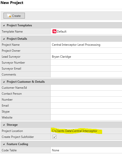
- Create a new job in Leica Infinity making sure that the folder you are using to back up your data is correct:
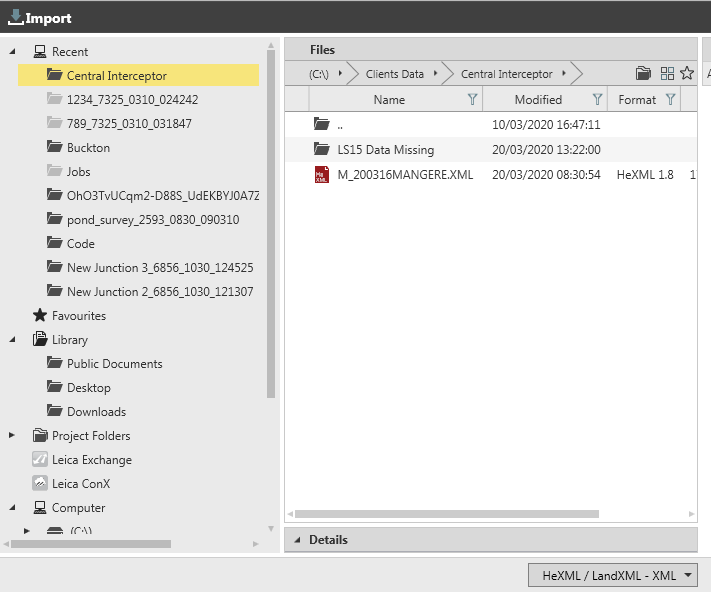
- Import XML Data
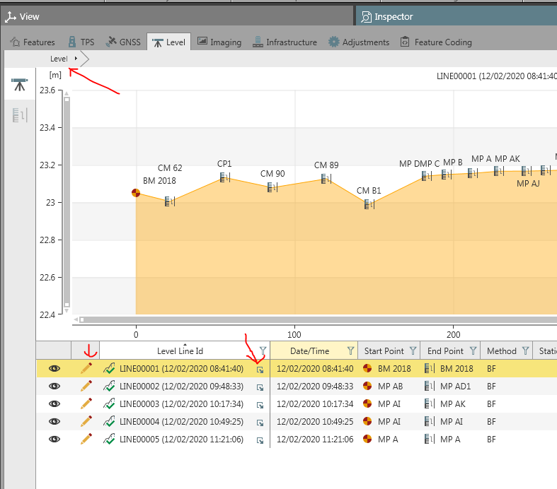
- Review Data in the Inspector Tab. Highlight the Level Line you wish to reduce. Expand out the Line you wish to reduce. Review your observations.
- Select the Level Tab to review all level; lines
- Select the pencil to perform Level Adjustment.
- Adjust Line Level Wizard is now active.
Settings: Adjustment Method is by Distance or Equally (per Station). Most adjustments are done by Distance as most systemic errors are proportional with distance. - Calculate Level Line. Select the start and end point as Control points by select the pen. If the point does not come up with the option to change to a Control point then you will need to import to the Points Library and create as Control.
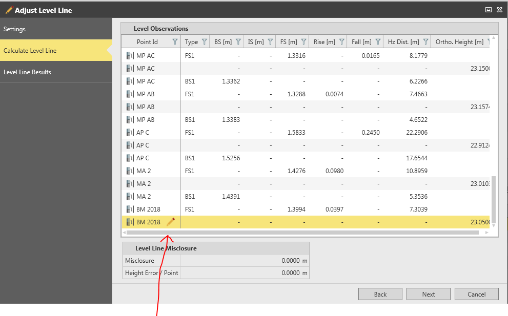
- By selecting next you will have adjusted the level run and a Results page will come up showing misclosure.
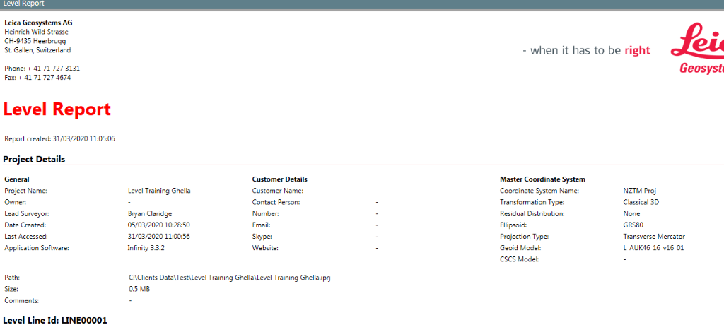
- Once you select Finish you will have saved the results and can now view the Level Report from the Reports tab. This report is customisable with your company Logo.
Tips for fixing Level data when in the Level Tab of the Inspector
To Split Lines select the point at where you wish to split and then RH mouse click onto change point and select the Split option.
If you wish to Join Lines RH mouse click on the area below the line in the graphical representation to bring up other lines within the same job. You can also reverse the direction of the line in this field.
If you need to rename the points in a level run you will need to import them into the Points Library and then select the right observation and then you can rename it in the Property Grid. A example of this is a return loop over the same control marks used as change points that are required to be averaged.