This process allows for WMTS and WFS datasets that are available from the LINZ data service to be used inside Leica Infinity software.
Items that may be of particular interest from the LINZ Data Service
- Aerial Photography
- Topographic and hydrographic
- Landonline data (including boundary and marks)
Requirements
You need a current Infinity CCP to activate and maintain this service.
Process
- Go to Koordinates (https://koordinates.com)
- Create a Koordinates Account
- Make sure you are logged into your Koordinates Account - Go to LINZ Data Service (https://data.linz.govt.nz/)
- Log in with your Koordinates account
- Browse LINZ Data Services to find relevant data
- Search NZ Imagery for WMTS Imagery
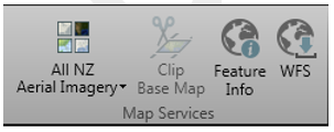
- Search on NZ Parcels for WFS Features - Click on the icon as shown in screenshot below and choose “Services” from the list.
-
Create an API key
- Click on Your dashboard
- Accept terms and create a key for Data Access Only
- Go Back to the previous page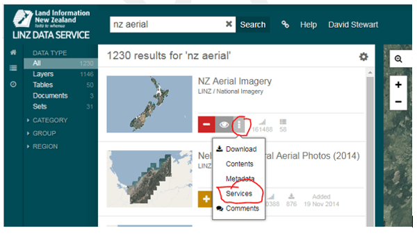
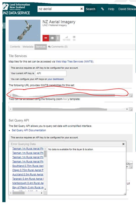
For WMTS (NZ Imagery tiles, NZ Topo 50 Tiles)
- Select a WMTS service, for example NZ Aerial imagery
- Copy the URL from the box under the heading “The following URL provides WMTS capabilities for this set” (see below)
- In Infinity (File/Services/Map Services) select the data type (WMTS) and the copies URL into the URL field
- Name the configuration
- Use your Koordinates Username and Password
- Tick the remember Credentials (this saves logging in each time you enter infinity)
- Press Get Capabilities – you will know if you have been successful if the Details and Data auto populate with the Metadata from LINZ data Service
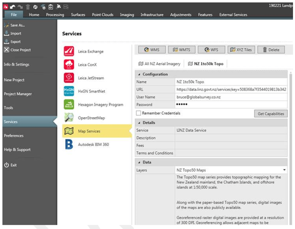
- Under the Map Services you will have access to you named WMTS services
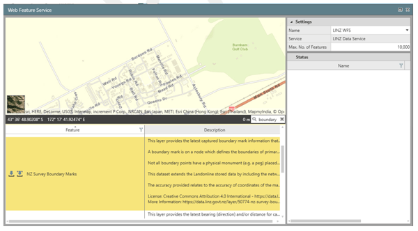
For WFS (Eg NZ boundary and control data)
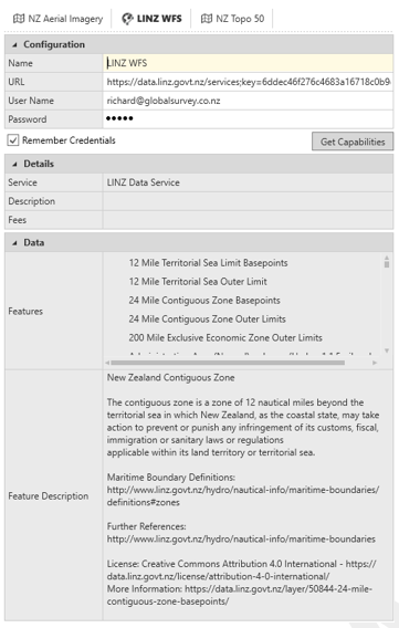
- Select a WFS service, for example NZ Parcels
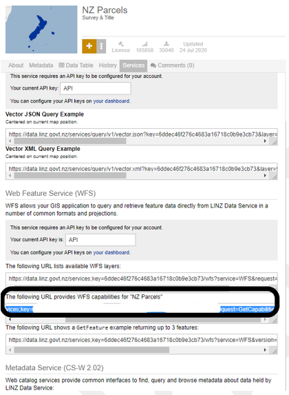
- Copy the URL from the box under the heading “The following URL provides WFS capabilities for "NZ Parcels" (see below)
- In Infinity (File/Services/Map Services) select the data type (WFS) and the copy URL into the URL field
- Name the configuration
- Use your Koordinates Username and Password
- Tick the remember Credentials (this saves logging in each time you enter infinity)
- Press Get Capabilities – you will know if you have been successful if the Details and Data auto populate with the Metadata from LINZ data Service
- Under the Map Services Click on WFS
- From the Web Feature Service panel, select the Feature you want and click Download Selection
- The Feature will be downloaded for the project view