*.geo files are created using the function “Extract Coordinates from AutoCAD Drawing”.
-
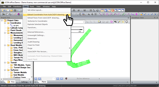
To create a *.geo file open your DWG or DXF file by double clicking on the file name so it displays in the main window. Then Go to Data → Extract Coordinates from AutoCAD drawing.
-
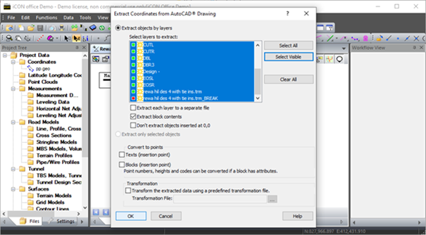
When you extract the coordinates from the AutoCAD Drawing you have some options to choose from. To select the visible data in your DXF or DWG click on select visible.
-
Click on OK to finish, this extracts the currently visible layers and creates a *.geo file containing points and linework.
-
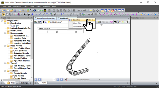
To save this file right click on the new tab and choose the option Save File (giving it a user-friendly name). Once named the *.geo file will appear in the project tree under coordinates.
-
To close the file right click and choose close file.