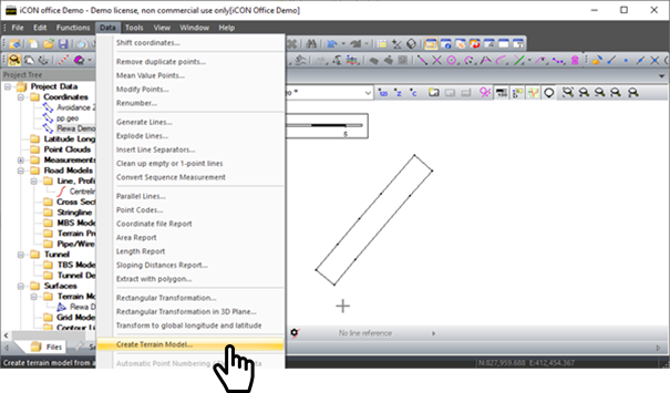
- To Create the Terrain Model go to Data → Create Terrain Model
-
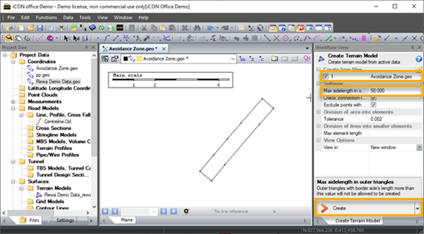
Select the *.geo files
-
Define the maximum search distance between points
-
Click create to create terrain model *.trm file.
-
Right click on the *.trm tab to save and name the terrain model and add it to the Project Tree.
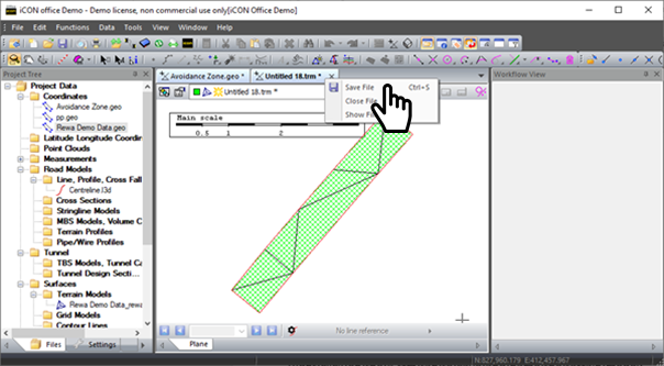
Note – if you need to trim the edges of your *.trm use the draw stop line function under Tools → Terrain Model